We use Google’s geo-coder to translate an address into a latitude and longitude set of coordinates to be placed on the map.
Free accounts no longer will use Google’s geo-coder. Instead a version of the open street maps (OSM) geo-coder is used. For improved geo-coding accuracy, it is recommended to sign up for a pro/premium/enterprise account since Google’s geo-coder is likely the best (although they have data errors from time to time). The information below mainly applies to Google’s geo-coder.
Sometimes an address is not found and other times it can be placed where it should not be. The geo-coder appears to work very well in most industrialized countries such as the United States. If a location cannot be mapped, sometimes modifying the address slightly will get the address to work. If you only have a zip (or postal) code adding a country will improve the accuracy if it gets placed in the wrong country.
Zip codes in the USA also need to have 5 digits, so if 00501 gets changed to 501 in excel it will not map correctly. An excel file can be modified so zip codes have leading zeros by following these instructions from Microsoft.
You can manually type in an address to see where Google’s geo-coder will place an address .
Be aware that google’s geo-coder is not the same as typing something in on Google Maps. Google maps most likely uses google’s vast search capabilities to find out where a restaurant, store, address, and other places should be placed on the map.
The accuracy of the geo-coding can be viewed in the EasyMapMaker Accuracy column in the data (emm_acc). The following 4 values can occur:
-
ROOFTOP
indicates that the returned result is a precise geocode for which we have location information accurate down to street address precision.
-
RANGE_INTERPOLATED
indicates that the returned result reflects an approximation (usually on a road) interpolated between two precise points (such as intersections). Interpolated results are generally returned when rooftop geocodes are unavailable for a street address.
-
GEOMETRIC_CENTER
indicates that the returned result is the geometric center of a result such as a polyline (for example, a street) or polygon (region).
-
APPROXIMATE
indicates that the returned result is approximate.
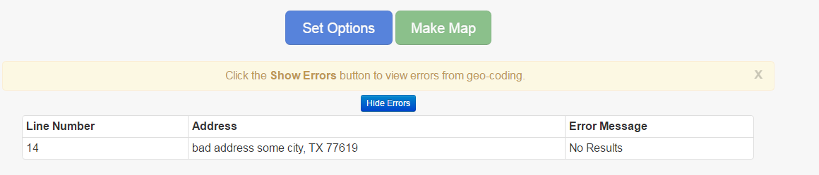
If an address does not have results, the address will be placed in the error table.
Errors in Error table:
One way to fix an address without results is to change the address if it is unclear. Other times the address can be removed so only the city, state, and zip code are used.